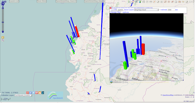
Initial data on earthquake was selected from the database of "Earthquake Archive Search" with the help of menu item in OpenWebGIS: "GeoDataBase-> Earthquakes Database".
For the analysis we choose a rectangle with coordinates:
lower left longitude: -89.53593749261435; lower left latitude: -6.373536989337675; upper right longitude: -72.44121093249441; upper right latitude: 5.382686176012323.
Magnitude range: from 2 to 10.
Date & Time(UTC): from 2016-03-01T00:00:00 to 2016-04-17T10:39:04.
The result of selecting, adding on the map and customizing the legend is shown on Figure 1.
 |
| Figure 1 - The earthquake in Ecuador on 17 April 2016: the result of selecting, adding on the map and customizing the legend in OpenWebGIS |
