Search This Blog

Sunday 21 June 2015

Top 10 tallest freestanding structures on the map


All buildings views (like 3D) given in this article were created with the help of OpenWebGIS and OSM Buildings. Read more about the integration of OpenWebGIS and OSM Buildings here: http://blog.osmbuildings.org/2015/06/integration-of-openwebgis-with-osm.html. At the end of the article there will be a description of how to create such maps in OpenWebGIS by yourselves.

10. The Willis Tower. Pinnacle height: 527 m; opening year 1974. It was built as and still commonly referred to as Sears Tower, is a 108-story, 1,451-foot (442 m) skyscraper in Chicago, Illinois, United States. See Figure 1 and open Map 1.

Wednesday 17 June 2015

Some new (June 2015) features and functions in OpenWebGIS


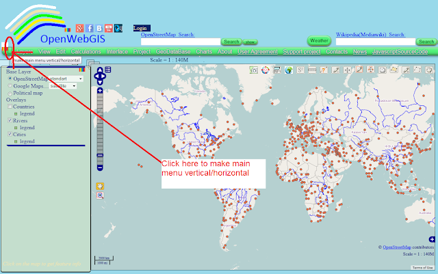
1. More opportunities for setting up the interface. Now, the main menu can be both horizontal and vertical. To do this, click on the appropriate button on the left on the main menu (see Figure 1 and Figure 2). After changing the color of the main menu and moving the menu in a convenient place for you (after you select the menu item "Interface" -> "Switch to interface drag") your interface might look like it is shown in Figure 3, or directly on the site of OpenWebGIS
Figure 1